
Bukhansan offers forest walks, fortress routes and an exposed granite summit within Seoul's transit reach. The correct question is not whether you can reach Baegundae; it is which route remains safe for your group on the day's conditions.
This Bukhansan Hiking Guide begins with route fit, weather and the descent—not the summit.
Key takeaways
Baegundae is a steep granite summit, not a paved city viewpoint.
Gentler lower routes and Dulle-gil sections still deliver forest and mountain scenery.
Carry water, traction-appropriate shoes, a layer, food, navigation and a charged phone.
Turn around when weather, crowding, daylight or group condition removes the safety margin.
Bukhansan National Park borders Seoul and Gyeonggi-do, and public transport can place hikers near several entrances. That convenience creates the most dangerous misconception: a mountain beside the subway is still a mountain. Trail surface, exposure, temperature and visibility can change quickly, especially on granite.
Visit Seoul's official overview gives Baegundae an elevation of 836.5 meters and emphasizes that the park contains routes for different abilities. We use those official route descriptions as planning anchors, then require a same-day Korea National Park Service and weather check before departure.
Which Bukhansan route fits you?
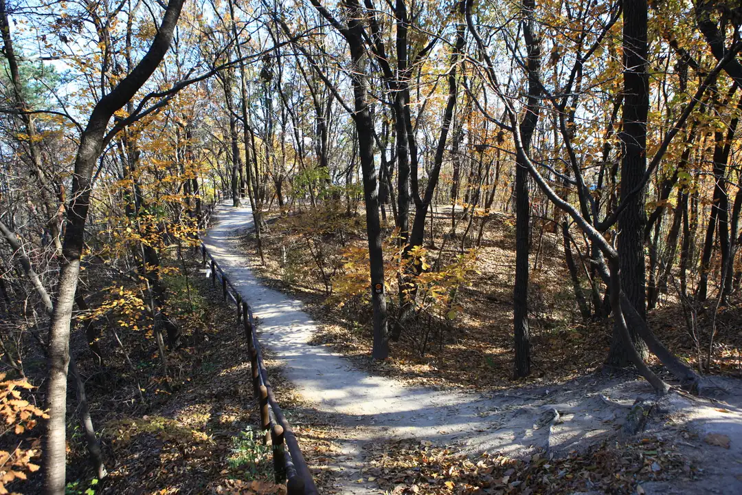
Gentle choice: a Dulle-gil section
Choose a Bukhansan Dulle-gil section when you want forest, foothill neighborhoods and a lower-consequence day. The loop trail is divided into sections, so identify the exact start, finish, distance and transit before leaving. Do not assume the word trail means flat; roots, slopes and seasonal mud still require suitable footwear.
Lower summit choice: Wonhyobong
Visit Seoul presents Wonhyobong as a more approachable summit route beginning near Bukhansanseong Information Center. The route still includes stone steps and a short rope-assisted area. It is a better first mountain goal for some hikers, not a guarantee of easy conditions.
Classic challenge: Baegundae
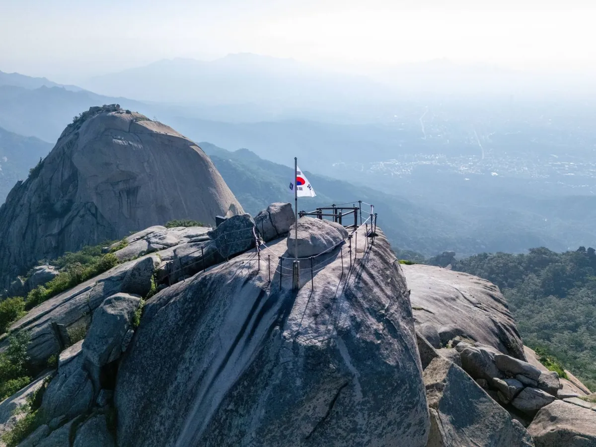
Baegundae is the park's highest point and the search result many visitors recognize. Visit Seoul describes the final section as very steep and rocky, with fixed wire ropes, and warns that weekend crowds can cause delays. A person uncomfortable with exposure, scrambling or close passing should choose another objective.
Historic advanced route: Bukhansanseong–Daenammun
The official course guide lists the Bukhansanseong–Daenammun traverse at 10.2 kilometers, about four hours ten minutes, and advanced difficulty. It passes fortress and palace sites and includes sustained climbing and descending. Published time is a route estimate, not a deadline; breaks, navigation, surface and crowds can lengthen it.
Why is Baegundae harder than it looks?
Photographs compress slope. Near the summit, hikers use fixed handlines on open granite while two-way traffic may share a narrow passage. Dry rock can feel secure; wet, icy or crowded rock can change the decision entirely. Gloves do not create grip for unsuitable shoes, and a handline does not remove fall risk.
Crowding matters because waiting near an exposed section consumes time and warmth. Start early enough to avoid a summit bottleneck, but never race other hikers. If the final rock is beyond your comfort or conditions are poor, turning below the summit is the correct completion of the plan.
The descent often produces more slips than the climb because legs are tired and hikers feel the objective is finished. Keep food, water and concentration for the return. Do not improvise a different descent unless you know where it exits and how you will reach your accommodation.
How do you reach Bukhansan from Seoul?
There is no single Bukhansan station. Entrances serve different routes. For the fortress side, official Visit Seoul guidance uses Gupabal Station on Line 3 followed by a local bus to the Bukhansanseong entrance. Other courses begin near Ui-dong, Gugi-dong, Jeongneung or Dobongsan. Match transport to the course, not the park name alone.
Save the Korean name of the trailhead and the final return stop. Mountain entrances can have similar visitor-center labels, and a route app may choose an entrance on the wrong side of the ridge. Tell someone the planned trail and exit. If joining a guide, confirm the meeting point, route, included gear, turnaround policy and return transport.
The journey is easier with a transit card, but the mountain should not be squeezed between fixed city bookings. Treat it as a substantial half or full day. The Korea transport cards and passes guide covers payment; the park notice remains the authority for access.
What gear do you need?
Hiking shoes with tread suited to rock, roots and the day's surface.
Enough water for the route, temperature and individual needs.
Food plus a small emergency reserve that does not depend on a summit vendor.
Weather layer, sun protection and a warm layer outside high summer.
Saved official map, charged phone and portable battery.
Small first-aid items and personal medication.
Traction equipment only when appropriate and used correctly for winter conditions.
Jeans, fashion sneakers and a tiny café bottle are not a sound Baegundae plan. Pack for a slower return than expected. Keep the bag light enough for balance and hands free for steep sections. Trekking poles can help on ordinary trail but must be managed carefully near rock and other hikers.
How do weather and season change the risk?
Rain makes granite and roots slippery and can reduce visibility. Thunderstorms create exposure on ridges and summits. Summer heat increases water demand and heat illness risk; begin early and reduce ambition. Winter ice can persist in shaded sections even when streets are clear. Spring and autumn temperature swings require layers.
Autumn foliage weekends bring heavy demand. The Korea autumn foliage guide helps with seasonal timing, but beauty is not a reason to accept unsafe crowding. Choose a lower route, weekday or early start. Never enter a closed section for a photograph.
Check the Korea National Park Service notice, hourly local forecast, precipitation, wind and sunset. Air-quality conditions also affect exertion. A forecast is not a contract; continue observing cloud, temperature, footing and group condition throughout the hike.
A safety plan before you leave
Write a route card: trailhead, checkpoints, objective, descent, exit, sunset and turnaround time. Set the turnaround based on the slowest hiker and difficult section, not on the published average. Tell a contact when you expect to finish and message when the group is off the mountain.
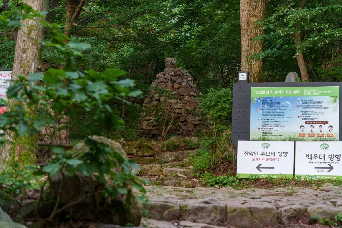
Stay on designated trails. Visit Seoul's safety guidance warns that side paths damage habitat, increase the chance of getting lost and create dangerous terrain. At junctions, confirm the sign before continuing. Photograph the sign or note your position so you can describe it if help is needed.
In an emergency, call Korea's emergency service and provide the clearest location available: trail name, nearest sign or marker, direction of travel and condition of the person. Keep the group warm and do not move an injured person unnecessarily. Follow ranger or emergency instructions.
When should you turn around?
A ranger notice or barrier closes the planned path.
Rain, lightning, ice, wind or low visibility changes the risk.
The group falls behind the pre-set turnaround time.
A hiker shows unusual fatigue, confusion, dizziness, chest pain or breathing difficulty.
Footwear or gear is inadequate for the next section.
Crowding removes safe spacing on exposed rock.
Turning around is not failure. The mountain will remain; your safety margin may not. A lower viewpoint and an uninjured return are more valuable than reaching the flag in conditions you cannot control.
Etiquette and conservation
Yield without stepping onto fragile vegetation, keep sound low, carry all waste out and do not feed wildlife. Let faster hikers pass at a safe wide place. On fixed lines, wait until the section is clear enough rather than crowding the person ahead. Summit photographs should never block the route.
Bukhansan also contains temples, fortress remains and historical landscapes. Treat religious spaces and heritage structures with respect, follow photography notices and avoid climbing on walls. The value of the hike is not limited to altitude.
What should you do after the hike?
Finish the mountain day near the exit you actually used rather than crossing Seoul for a famous meal. Cool down gradually, change out of wet layers, drink water and eat a normal meal. If pain changes your gait, swelling increases or symptoms such as confusion, chest pain or breathing difficulty persist, seek appropriate medical help instead of treating every problem as ordinary soreness.
Do not schedule a ticketed evening immediately after an unfamiliar summit route. Descent, buses and weekend traffic can all take longer than expected. A flexible neighborhood dinner or early night protects the next day. Use top things to do in Seoul to place museums or palace visits on a separate day rather than attaching them to the hike.
Clean mud from footwear before entering transit, keep poles secured and make room for commuters. Record the actual route and time while details are fresh; that information is more useful for a future hike than the published estimate. Message the contact who received your route plan so they know you are safely off the mountain.
Frequently asked questions
Is Bukhansan suitable for beginners?
The park has gentler routes, but Baegundae's final rock section is not a simple beginner walk. Choose a Dulle-gil section or lower objective based on fitness, weather and exposure comfort.
How long does Baegundae take?
Time depends on trailhead, route, pace, crowding and surface. Official descriptions provide course estimates, but plan with daylight and turnaround margins rather than using a summit time as a promise.
Can I hike Bukhansan alone?
Experienced, prepared hikers do, but solo travel reduces the support available after a fall or navigation error. Share the route, stay on designated trails, carry communication and choose conservative conditions.
Is there an entrance fee?
General national-park trail access is commonly free, while parking, temples, programs or other services may differ. Check the current park and facility notices for the exact entrance you plan to use.
Last verified: August 30, 2026 by the TipsKorea editorial team. Trail status, closures, weather and access can change quickly; check Korea National Park Service information on the morning of the hike.
Sık Sorulan Sorular
Is Bukhansan suitable for beginner hikers?
Some lower routes and Dulle-gil sections suit beginners, but Baegundae's final exposed granite and fixed handlines require confidence, fitness and suitable conditions.
How long does a Bukhansan hike take?
It depends on trailhead, route, pace, surface and crowds. Use the official course estimate only as a baseline and set a conservative daylight turnaround.
Can travelers hike Bukhansan alone?
Prepared hikers do, but solo hiking reduces support after a fall or navigation error. Share the route, stay on marked trails and choose a conservative objective.
What should I bring for Bukhansan?
Bring treaded hiking shoes, sufficient water, food, weather layers, sun protection, a saved map, charged phone, battery and personal medication.
Son doğrulama: Ağustos 2026 · TipsKorea Editörleri


